DJI’s Matrice 5T Puts More Sensors on an Inspection Drone. The Evidence Still Needs a Human
DJI combines thermal, LiDAR, radar and vision sensing in its Matrice 5T; operators still need to validate anomalies and plan safe flights.
On this page
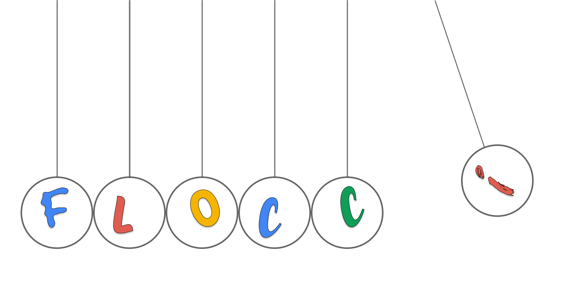
An inspection crew can spend more time reaching a structure than interpreting it. DJI’s new Matrice 5T is designed to put thermal, optical, radar and LiDAR sensing on one compact enterprise aircraft, so an operator can compare several views during the same mission. That combination is most useful when it improves coverage or finds a follow-up question; it cannot by itself determine whether a warm component is a defect or whether a flight is safe to run.
Four sensing modes solve different problems
DJI announced the Matrice 5T on November 5. The company lists a native thermal resolution of 1,280 × 1,024 pixels, with an optional ultra-high-resolution infrared mode at 2,560 × 2,048. Its camera payload also includes wide, medium-telephoto and telephoto visible-light cameras. The aircraft adds rotating LiDAR, millimeter-wave radar and omnidirectional vision sensors. [1] [2]
These tools answer different questions. Thermal imaging shows relative or measured temperature patterns; visible cameras help an operator inspect surface details; LiDAR estimates geometry and can help detect thin obstacles such as wires; radar can contribute when rain, dust or fog makes optical sensing less useful. DJI also describes combining visual and radar data for positioning in weak-GNSS environments. The value comes from the overlap: an operator can compare a flagged heat pattern with the component’s visible condition and surroundings rather than relying on a single feed. [1]
The company says its onboard AI can detect more than 20 target types and analyze thermal and visible feeds in parallel. That is a capability claim, not evidence that the aircraft can make a maintenance diagnosis or safely replace an inspector. A model can help direct attention, while the person responsible for the inspection checks the target, decides what evidence is sufficient and records uncertainty. [1]
Better coverage is not the same as proof
A thermal image can identify a difference that merits investigation, but temperature depends on context: load, ambient conditions, viewing angle, surface properties and recent operation can all matter. DJI’s specs list measurement ranges and accuracy values, but those are not a universal field guarantee. Treat an alert as a cue to compare like-for-like components and conditions, then follow the asset owner’s inspection procedure. If an issue has safety or service consequences, a qualified person should decide whether to repeat the measurement, inspect at closer range or use another method.
The same principle applies to obstacle sensing. A LiDAR point cloud, radar return or visual-positioning system supplies additional perception inputs; it does not remove the operator’s duty to plan a route, maintain situational awareness or account for site-specific hazards. DJI’s published data includes controlled conditions and caveats. For example, the 59-minute maximum flight time was measured at sea level in a wind tunnel with no payload and the aircraft flying forward until zero battery. A real inspection plan needs reserve power and must account for accessories, wind and temperature. [2]
DJI states that the aircraft achieved an IP55 rating under controlled laboratory testing and publishes the test conditions. That can inform equipment selection, but it is not a reason to fly in any weather or ignore maintenance and operating limits. The published operating temperature range is −20°C to 50°C, and the vendor notes the protection rating can decrease with wear. [2]
The flight plan remains a product feature
The aircraft is intended for enterprise inspection, surveying and emergency response. Those missions often involve power lines, bridges, industrial sites or populated areas, each with distinct airspace, site-access and privacy requirements. A sensor package does not authorize a flight. In the United States, for example, FAA Part 107 rules generally require the drone to remain within visual line of sight and impose other operating conditions; other countries have their own requirements. Operators should check the rules for the actual location and mission before choosing a platform. [3]
A practical pilot should begin with one recurring inspection problem. Define what finding the drone should surface, what a human must verify, how evidence will be attached to an asset record and what conditions invalidate a measurement. Run the new aircraft beside the current process long enough to compare missed findings, false alarms, time on site and reinspection rates. Keep the raw source images and environmental context needed to review a flagged item later.
DJI’s release is a meaningful move toward multi-sensor inspection in a smaller enterprise aircraft. For utilities and response teams, the useful question is not how many sensors fit on the airframe; it is whether their combined data supports a safer, repeatable decision without creating a new blind spot. The operator and inspection process remain part of the system.
Related background: how H3’s hexagonal indexing supports location systems and edge AI’s limits in real-world sensing.
Frequently asked questions
What is new about the DJI Matrice 5T?
DJI announced the enterprise drone with a 1,280 by 1,024 thermal camera, LiDAR, millimeter-wave radar, low-light vision sensing and onboard AI features. The system combines these sensors for inspection and emergency-response workflows.
Does a thermal image prove that electrical equipment is faulty?
No. Thermal imagery helps locate temperature differences, but an operator must interpret them in context, account for measurement conditions and confirm findings with appropriate inspection procedures.
Does the 59-minute flight-time figure describe a typical inspection?
No. DJI lists 59 minutes as a maximum measured in a controlled wind-tunnel test without payload at sea level. Accessories, wind, temperature, flight mode and reserve requirements change usable flight time.
Sources & further reading
Keep reading
Renesas Puts Robot Motion, Industrial Ethernet and Linux on One Chip
The RZ/T2N combines real-time motor control and application processing, while engineers still need to prove timing, safety and network behavior.

ST’s SoftSIM and SGP.32 Aim to Remove a Factory Choice from IoT Fleets
ST’s NB-IoT update combines SoftSIM, SGP.32 provisioning and Zephyr support, but carrier agreements and lifecycle ownership still matter.
ESA's Grid Resilience Call Asks Where Satellites Can Help After a Disruption
ESA's new proposal call explores satellite data and communications for grid resilience, while leaving control and procurement decisions with utilities.
/* Comments */
Comments are offline right now — we reconnect automatically, nothing is lost.